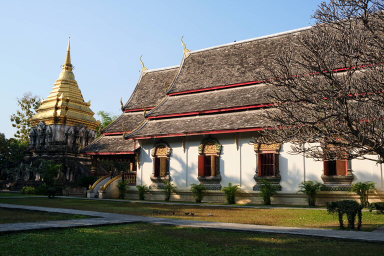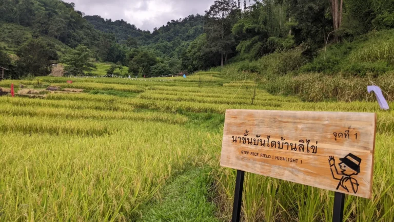
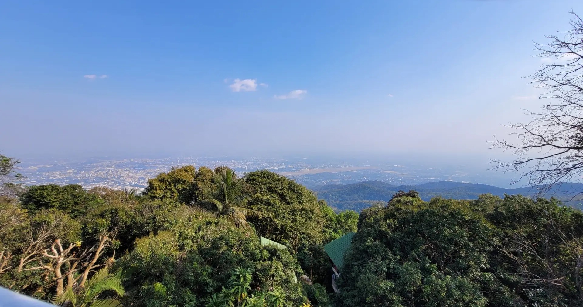
Monk’s Trail Loop: 10.6km Sacred Hike Through Chiang Mai’s Mountains
Looking for Chiang Mai’s most iconic hike? The Monk’s Trail to Wat Pha Lat and Doi Suthep has been a pilgrimage route for centuries—but this 10.6-kilometer loop takes it to the next level. Instead of simply climbing to the temples and taking a songthaew back down, this route circles through the entire Doi Suthep-Pui National Park, combining sacred sites, jungle trails, and cascading waterfalls into one unforgettable day.
Starting near Chiang Mai University, this trail follows the ancient path monks once used to reach Wat Phra That Doi Suthep, Northern Thailand’s holiest temple. Along the way, you’ll discover Wat Pha Lat—the “hidden jungle temple” that’s become one of Chiang Mai’s most photographed spots—before climbing to the golden chedi at 1,073 meters elevation. But unlike most hikers, you won’t retrace your steps. Instead, you’ll descend the western slope through pristine forest, passing waterfalls and giant fig trees before completing the loop back at the trailhead.
The Monk’s Trail has evolved significantly since I first hiked it. What was once marked by saffron cloth tied to trees is now clearly signed with colorful banners, making it accessible to everyone—though the spiritual atmosphere remains. This loop combines Chiang Mai’s most famous temple hike with a wilder, quieter return through sections of trail that see only a fraction of the crowds.
Technical Specs
📏 Distance : 10.6 km
📈 Elevation Gain : 650 m
🏔️ Max Altitude : 1073 m
📉 Min Altitude : 320 m
⏱️ Duration : 4:00
Practical Info
📊 Difficulty : 🟡 Moderate
⭐ Scenery Rating : 5 / ⭐⭐⭐⭐⭐ (Breath-taking) / 5
📍 Nearby Town : Chiang Mai University
This is the main hub and the starting area for this trail.
Interactive Trail Map & Elevation
THE MONK’S TRAIL & CHIANG MAI UNIVERSITY START
Before hitting the trail, it’s essential to understand the cultural significance of the Monk’s Trail. This ancient pilgrimage route has been used for centuries by Buddhist monks walking from the city of Chiang Mai to Wat Phra That Doi Suthep, the most sacred temple in Northern Thailand. The trail winds through dense jungle, gaining 650 meters of elevation over a relatively short distance, making it both a physical challenge and a spiritual journey.
The starting point is located near Chiang Mai University, in the Suthep sub-district. Unlike the more remote trails in Chiang Rai, this hike begins right on the edge of the city, making it incredibly accessible. I found parking to be straightforward—there’s a small lot at the trailhead where you can leave your scooter or car for the day.
Logistics & Parking:
- Parking: Free parking area at the Monk’s Trail entrance near Chiang Mai University
- Best Season: November-February (cool and dry); avoid rainy season when trails get slippery
- Water: Bring at least 1.5 liters—there are no shops until you reach Wat Phra That Doi Suthep
The Ascent: Following the Ancient Pilgrimage Route
The first section of the Monk’s Trail is what makes this hike legendary. As I started the climb from the university area, I immediately entered the forest canopy. The trail is well-marked now—colorful prayer flags and banners hang from trees at regular intervals, a far cry from the simple saffron cloths that monks originally used to mark the way.
The path itself is a mix of natural dirt, exposed roots, and occasional stone steps. I found the gradient to be steady but manageable—it’s a continuous climb, but nothing too steep. What makes this section special is the atmosphere. Even though you’re just minutes from Chiang Mai’s urban sprawl, the jungle feels completely remote. The sound of birds and insects replaces city traffic, and the temperature drops noticeably under the forest canopy.
After about 45 minutes to 1 hour of climbing (depending on your pace), you’ll start to hear the sound of running water. This signals that you’re approaching the first major landmark of the hike.
Wat Pha Lat: The Hidden Jungle Temple
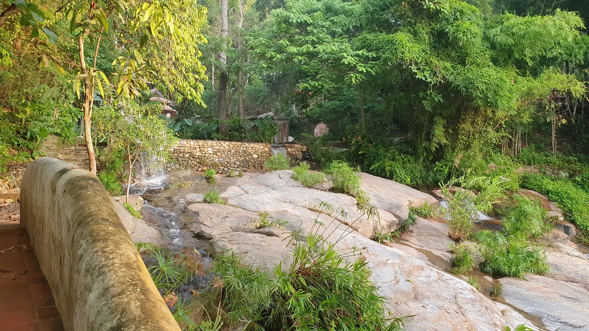
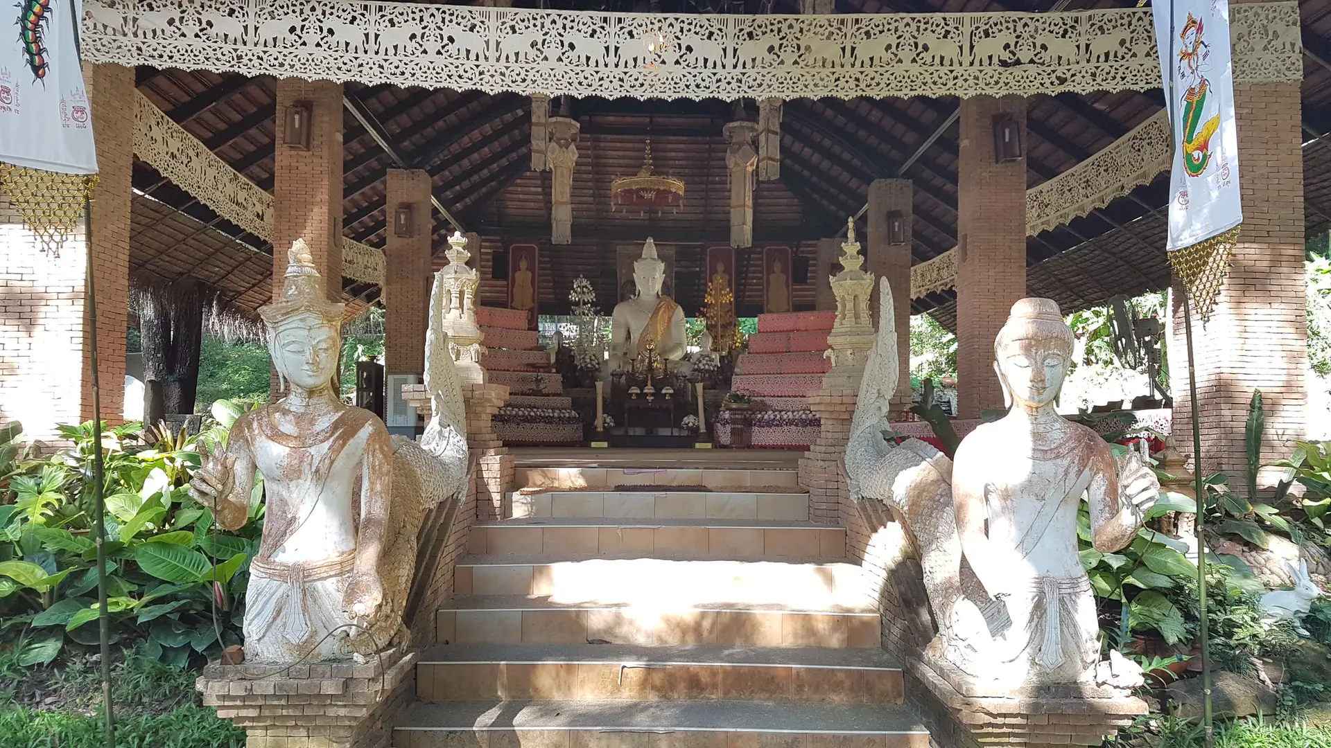
Around the 1.17 km mark, the trail opens up to reveal Wat Pha Lat, also known as “the monastery at the sloping rock.” I have to admit, this was one of the most unexpected discoveries on any hike I’ve done in Thailand. Unlike the crowds and tourist buses at Doi Suthep, Wat Pha Lat feels genuinely hidden—a secret temple tucked into the mountainside.
The temple complex is built directly into the natural rock formations, with small streams and waterfalls running through the grounds. The architecture blends seamlessly with the jungle surroundings. I particularly loved the moss-covered Buddha statues positioned along the water channels—they’ve become Instagram-famous, but in person, they’re genuinely peaceful and contemplative.
What makes Wat Pha Lat special:
- Built in 1355 as a resting point for monks traveling to Doi Suthep
- Completely integrated into the natural landscape with waterfalls flowing through the temple
- Far fewer tourists than Doi Suthep (most people drive directly to the summit)
- Free to visit with no entrance fee
- Opportunities for meditation and quiet reflection
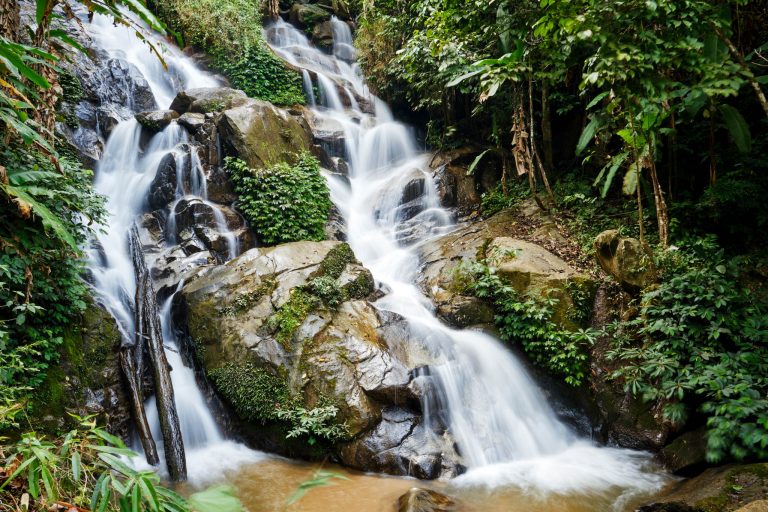
The waterfalls at Wat Pha Lat (marked at km 1.11 on the trail) are modest but refreshing. The water cascades over natural rock formations, creating small pools where temple grounds meet jungle. I recommend spending at least 20-30 minutes here exploring the different levels of the complex and enjoying the tranquil atmosphere before continuing the climb.
THE STEEP CLIMB TO DOI SUTHEP
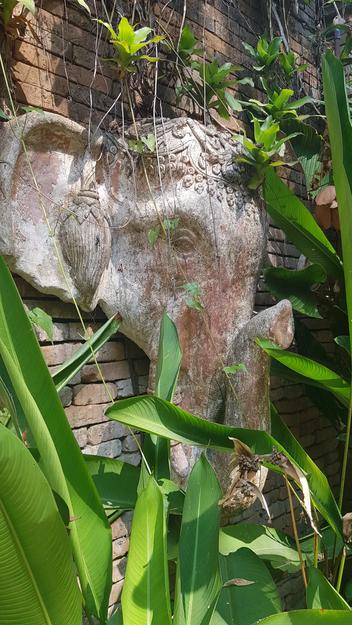
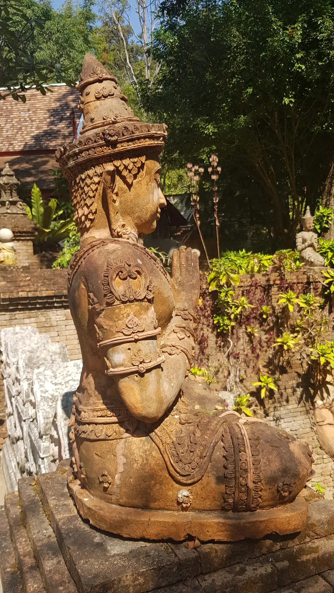
After leaving the peaceful grounds of Wat Pha Lat, the trail transforms. This is where the hike gets serious. The next 2 kilometers involve the steepest and most demanding section of the entire loop—a relentless climb that gains approximately 300 meters in elevation as you push toward the summit.
I found this section to be significantly more challenging than the initial ascent to Wat Pha Lat. The path narrows and becomes rockier, with exposed tree roots creating natural staircases in many places. The gradient is steep enough that I needed to take several breaks, especially in the humidity. This is where having good hiking shoes really matters—the terrain can be slippery, particularly if there’s been recent rain.
What keeps you motivated during this climb is knowing what awaits at the top. As you get closer to the 3-kilometer mark, you’ll start to notice the forest thinning slightly, and occasional glimpses of the valley below appear through breaks in the canopy.
Khun Khan Viewpoint: First Glimpse of Chiang Mai
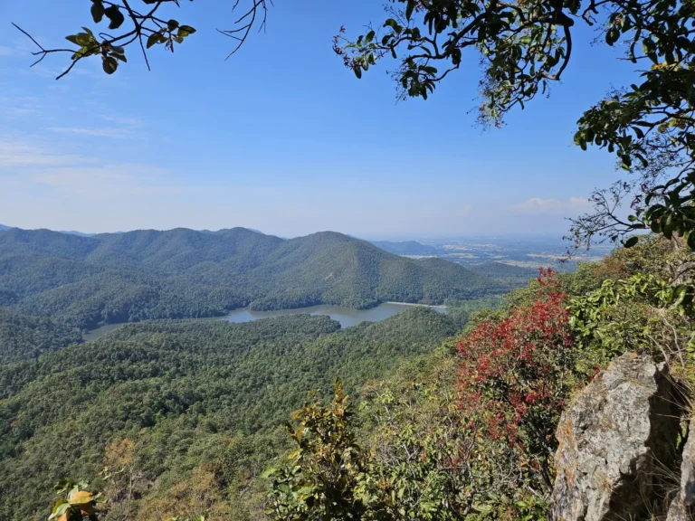
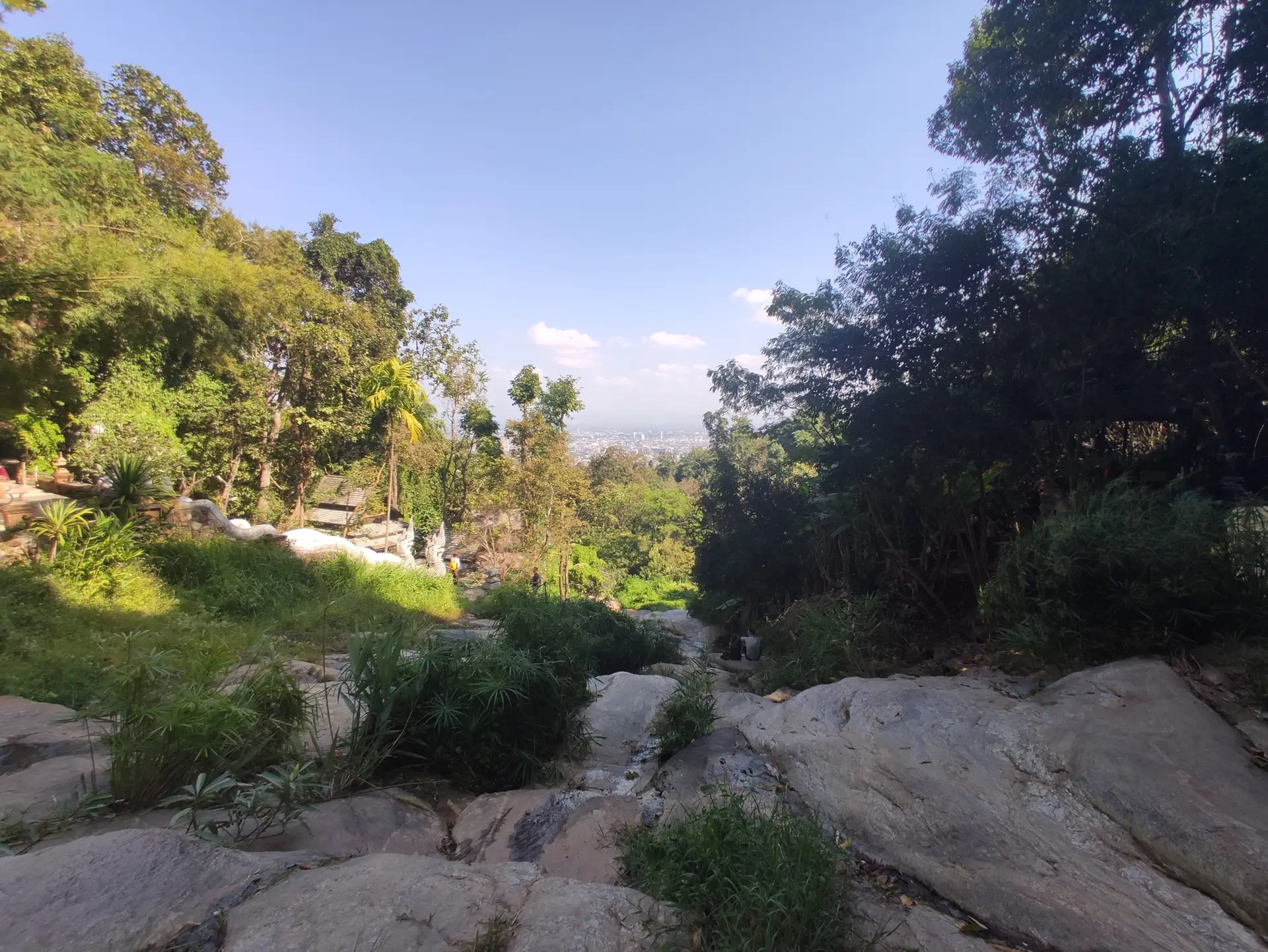
At approximately km 3.05, you’ll reach โค้งขุนกัน (Khong Khun Khan), the main viewpoint overlooking Chiang Mai city. After the enclosed jungle climb, this opening feels dramatic. I reached this spot around mid-morning, and the view was absolutely worth every meter of elevation gain.
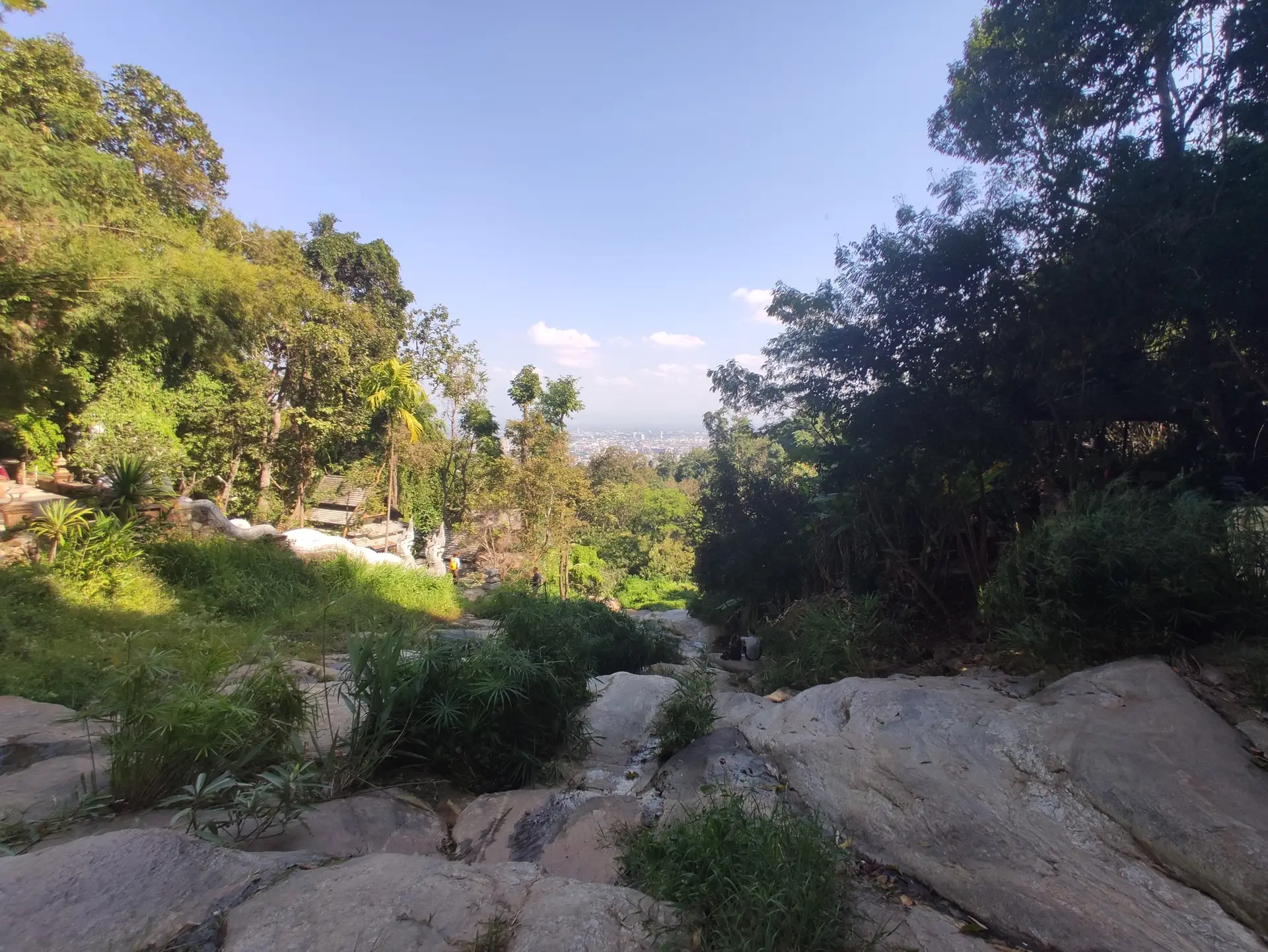
From this vantage point at roughly 1,000 meters elevation, the entire Chiang Mai valley spreads out before you. On clear days, you can see the geometric patterns of the old city moat, the sprawling university campus below, and the mountains rolling away toward the horizon. The contrast between the dense green jungle you’ve been climbing through and the urban landscape below is striking.
I recommend taking a proper break here. There’s usually a light breeze at this elevation that feels incredible after the humid climb. This is also a good spot to hydrate and prepare mentally for the final push to Wat Phra That Doi Suthep, which is now just a few hundred meters away.
WAT PHRA THAT DOI SUTHEP: CHIANG MAI’S GOLDEN CROWN
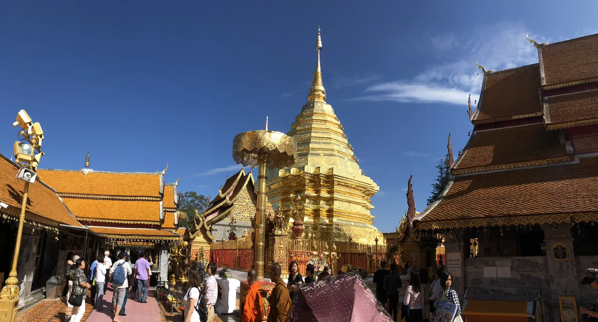
From the viewpoint, the trail continues upward for another 200 meters or so before you suddenly emerge from the jungle onto paved ground. And then you see it—the golden chedi of Wat Phra That Doi Suthep gleaming in the sunlight.
The transition from wilderness trail to one of Thailand’s most important pilgrimage sites is jarring. Suddenly, you’re among tour groups, vendors selling flowers and incense, and the sound of temple bells. But arriving on foot via the Monk’s Trail gives you a completely different perspective than the tourists who’ve taken songthaews or private cars up the mountain road.
Wat Phra That Doi Suthep is not just another temple—it’s the spiritual heart of Northern Thailand. Founded in 1383, the temple houses a relic of the Buddha and is considered one of the most sacred sites in Thai Buddhism. The legend of its founding is fascinating: a white elephant carrying a Buddha relic climbed Doi Suthep mountain, trumpeted three times, turned around three times, and then died on this exact spot. King Nu Naone interpreted this as a divine sign and ordered the temple built here.
What you’ll find at Wat Phra That Doi Suthep:
- The famous 309-step Naga staircase (which you’ve earned the right to skip by hiking up!)
- The golden chedi at the center of the complex, covered in gold plates
- 360-degree views of Chiang Mai from the temple terraces
- Ornate murals depicting the life of Buddha
- Monks chanting and performing daily rituals
- A small museum about the temple’s history
The entrance fee is 30 baht for foreigners. I arrived sweaty and dusty from the trail, but no one minds—the monks understand that people arrive via the hiking route. There are clean restrooms here where you can freshen up.
I spent about 45 minutes to an hour exploring the temple complex. The central chedi is genuinely impressive, especially when the afternoon sun hits the gold plating. If you’re there during the right time, you might witness monks performing their rituals, which adds another layer of spiritual significance to the experience.
Important note: This is an active place of worship. Dress respectfully (shoulders and knees covered), remove your shoes before entering temple buildings, and be mindful of your behavior. The fact that you’ve hiked here rather than taking the easy route doesn’t exempt you from these rules.
THE LOOP RETURN: GIANT FIG TREE & WESTERN DESCENT
After exploring Wat Phra That Doi Suthep and soaking in the panoramic views, it’s time to tackle the second half of this loop—and this is where most hikers miss out. Instead of retracing your steps down the Monk’s Trail or catching a songthaew back to the city, the loop continues deeper into Doi Suthep-Pui National Park.
From the temple complex, you’ll follow a paved road briefly before picking up the trail that heads northwest into the protected forest. This section sees far fewer people than the famous Monk’s Trail, which means you’re trading the spiritual pilgrimage atmosphere for genuine wilderness solitude.
The path climbs slightly at first—yes, more climbing even after reaching Doi Suthep—as you work your way around the western slope of the mountain. I found this section to be less steep than the earlier ascent, but the trail is narrower and less maintained. You’re fully in the national park now, and it shows. The vegetation is thicker, the canopy denser, and the sounds of civilization completely disappear.
The Giant Fig Tree (Km 4.34)
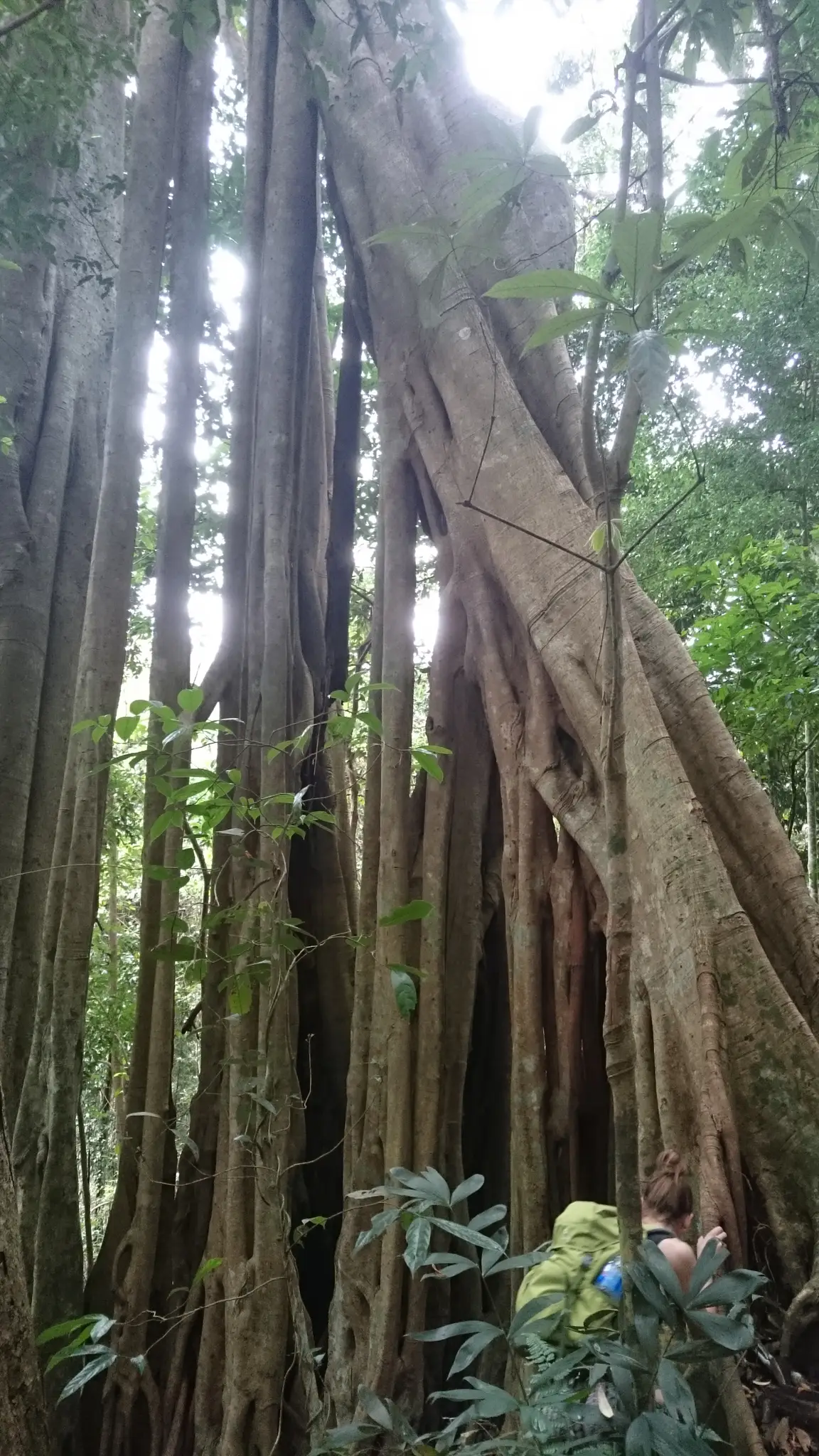
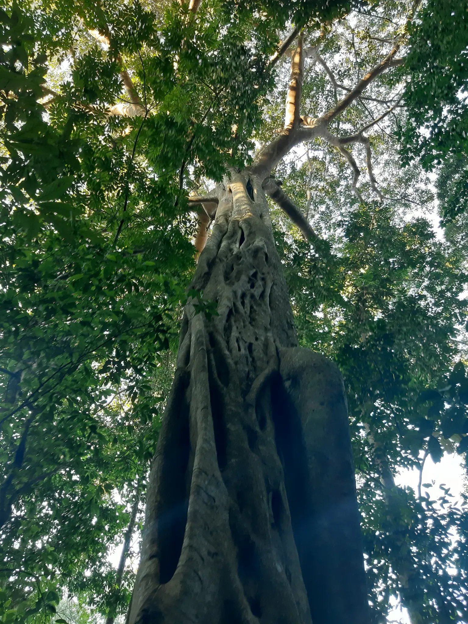
Around the 4.34-kilometer mark, not long after leaving Doi Suthep temple, you’ll encounter one of the trail’s more subtle highlights: a massive fig tree. This ancient tree stands as a natural monument within the park, estimated to be several hundred years old. The root system is incredible—thick aerial roots spread across the ground like natural sculptures, and you’ll need to navigate carefully around them.
I spent a few minutes here just appreciating the scale of this tree. These giant figs are scattered throughout Doi Suthep-Pui National Park, and they serve as important markers for the local ecosystem. Birds and small mammals rely on them for food and shelter. Standing next to something that’s been here for centuries puts the entire hike into perspective—you’re walking through a landscape that’s much older than any of the temples you’ve just visited.
Doi Suthep-Pui National Park Waterfalls (Km 5.83)
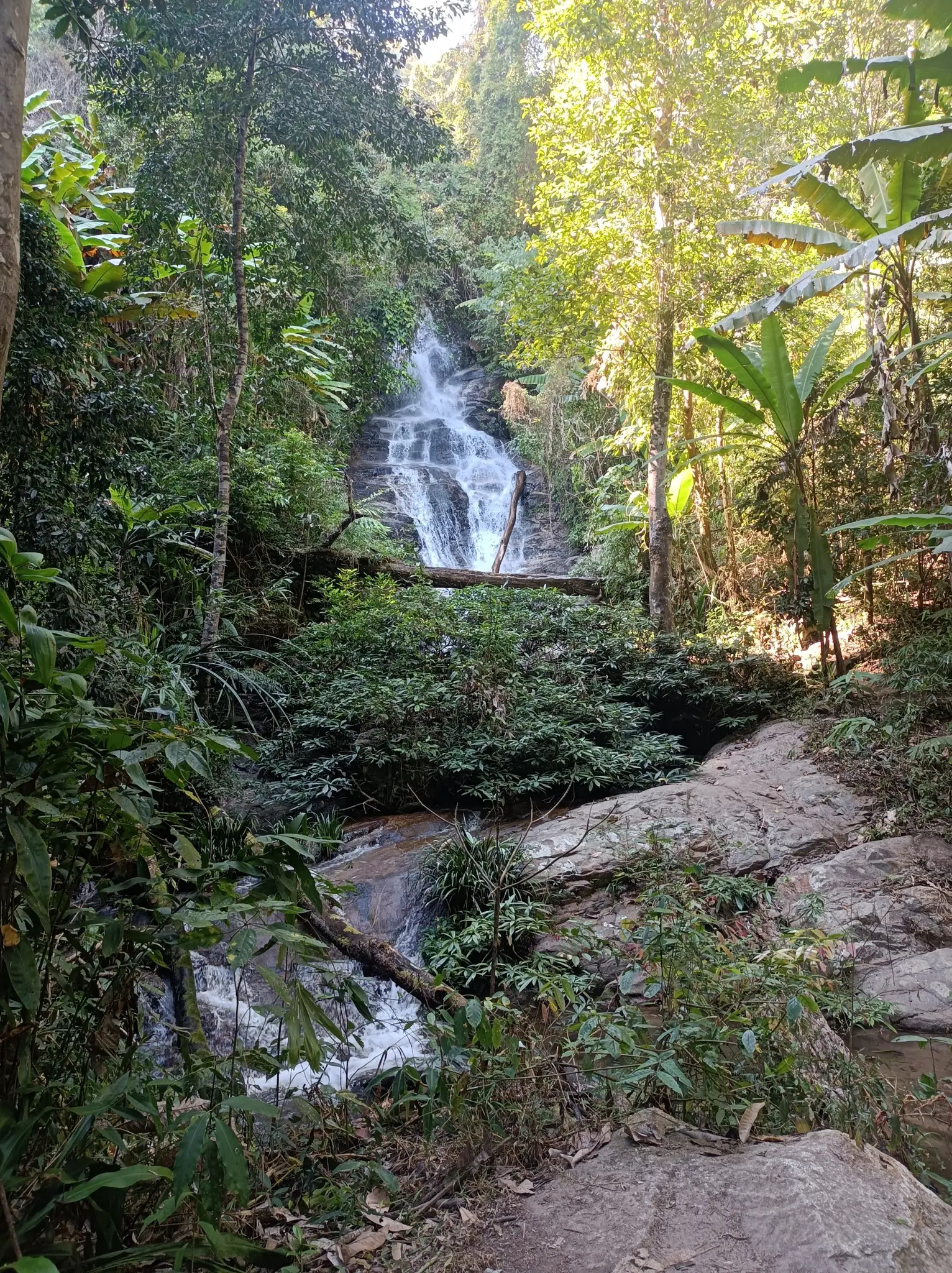
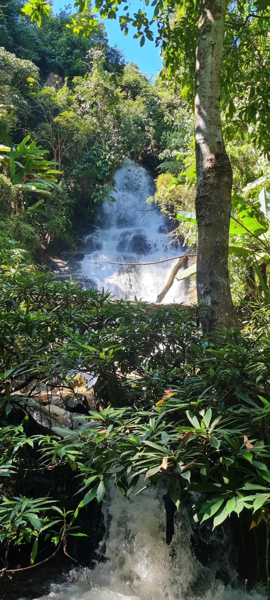
Continuing deeper into the forest, around the 5.83-kilometer mark, you’ll reach a series of waterfalls within the national park boundaries. These cascades are completely different from the temple waterfalls at Wat Pha Lat—they’re wilder, more powerful, and entirely natural with no human structures around them.
I arrived at these waterfalls in the early afternoon, and the timing was perfect. After hours of hiking in the heat, the spray from the falls felt incredible. The waterfall isn’t massive—it’s not going to compete with giants like Khun Korn in Chiang Rai—but it’s beautiful in its own right, cascading over moss-covered rocks into clear pools below.
What makes this spot special is the solitude. While Wat Pha Lat might have 20-30 other visitors at any given time, I had these waterfalls almost entirely to myself. The only sounds were the rushing water and the forest around me.
The water quality here is excellent—this is pristine national park territory. Swimming is possible in the pools below the falls, though the water is quite cold due to the elevation. I didn’t take a full swim, but I did cool off my feet and refill my water bottle (I always carry purification tablets for situations like this).
The Descent
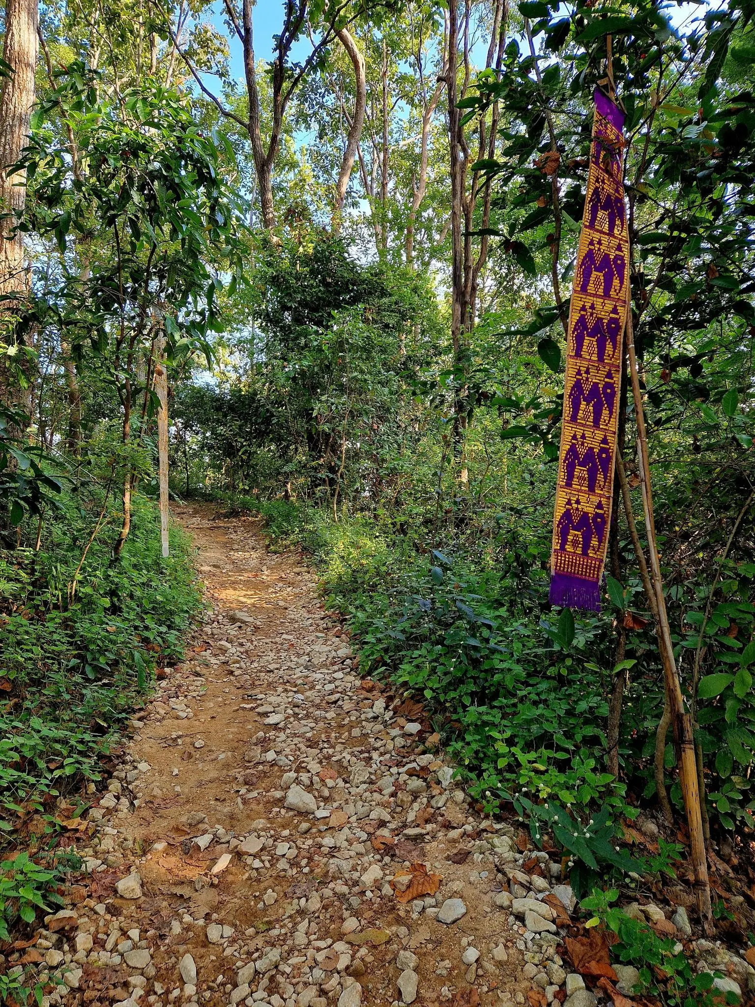
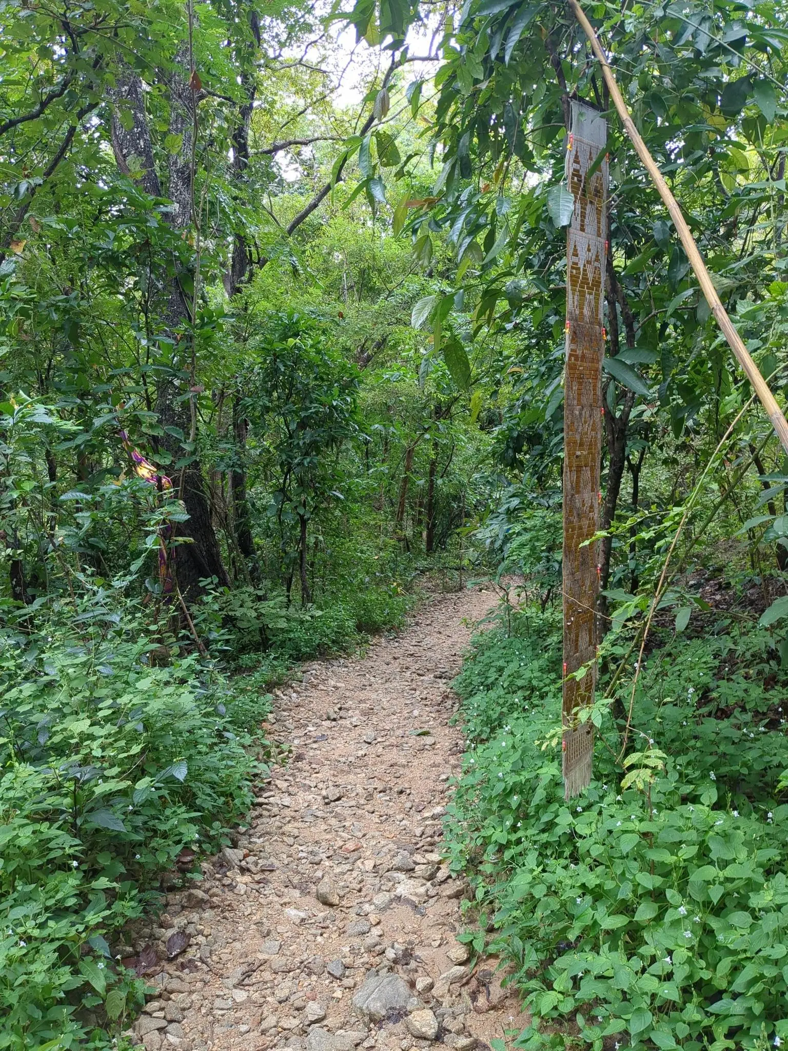
After the waterfalls, the trail enters its longest section: the eastern descent. This is approximately 4-5 kilometers of steady downhill through dense jungle. I found this section to be the most meditative part of the entire loop. There are no major landmarks, no temples, no viewpoints—just you, the forest, and the rhythm of descending.
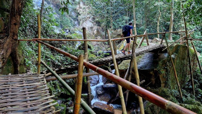
The path surface varies considerably on this western slope. You’ll encounter everything from packed dirt to loose rocks, exposed roots, and occasional muddy sections (even in dry season, some spots stay damp due to the thick canopy). The gradient is generally gentle, but there are a few steeper pitches where I had to watch my footing carefully.
What I appreciated about this descent was its complete contrast to the Monk’s Trail. Where the eastern ascent is well-marked and clearly defined, the western route feels more adventurous. You’re following a legitimate hiking trail, but it’s not manicured for tourists. This is the Doi Suthep-Pui National Park as nature intended—raw, green, and quiet.
After nearly 4 hours of hiking since leaving the trailhead, my legs definitely felt the cumulative impact of 650 meters of elevation change. The sustained downhill can be tough on the knees, so I recommend using trekking poles if you have them, and taking your time rather than rushing.
Around km 10.4, you’ll see the first signs of the trail’s end: colorful prayer flags marking the lower entrance to the Monk’s Trail. This is where the loop completes. From here, it’s just a few hundred meters back to the parking area near Chiang Mai University where you started.
After 10.6 kilometers, 650 meters of elevation, sacred temples, hidden waterfalls, and hours of jungle immersion, seeing that parking area again feels genuinely satisfying. This isn’t just a hike—it’s a complete journey through Chiang Mai’s spiritual and natural heritage, compressed into a single unforgettable loop.
Practical Tips for this Hike
Timing & Season:
- Best months: November-February (cool season) for comfortable temperatures and clear skies
- Rainy season: June-October brings lush greenery but slippery trails—exercise caution
- Avoid: March-May (hot season) when temperatures can exceed 35°C and humidity is oppressive
- Start time: Aim to begin before 8:00 AM to avoid midday heat and afternoon crowds at Doi Suthep
Cultural Etiquette:
- Remove shoes before entering any temple buildings
- Dress modestly (no shorts, tank tops, or revealing clothing)
- Speak quietly and respectfully within temple grounds
- Ask permission before photographing monks
- If you see monks on the trail, step aside and let them pass first
Getting to the Trailhead
The Monk’s Trail trailhead is located near Chiang Mai University in the Suthep sub-district, making it one of the most accessible hikes in Northern Thailand. Unlike remote mountain trails, this one starts right on the edge of the city.
Rent a Scooter (Recommended):
- Widely available in Chiang Mai’s Old City and Nimman area
- Cost: approximately 150-250 THB/day
- Journey time: 15-20 minutes from Old City center
- Road conditions: Fully paved all the way to trailhead
- Parking: Free parking area at Monk’s Trail entrance near Chiang Mai University
- Navigation: Easy to find—just head toward Chiang Mai University and follow signs for “Monk’s Trail” or “Doi Suthep”
Red Songthaew (Local Shared Taxi):
- Catch one heading to Chiang Mai University from the Old City
- Cost: 40-60 THB per person one-way to the trailhead
- Frequent departures throughout the day
- Ask driver for “Monk’s Trail start” or show them the GPS coordinates
- Return: Easy to catch a songthaew back from the same spot after your hike
Private Taxi/Grab:
- Available via Grab app or negotiate with local taxis
- Cost: 150-250 THB one-way from Old City
- Most convenient if carrying heavy gear or hiking with a group
- Driver can wait at trailhead, but this is unnecessary (4+ hour hike)
Tuk-Tuk:
- Available but less practical due to open-air design
- Cost: 200-300 THB one-way (negotiate before departure)
- Fine for getting there, but songthaew is better value for return
GPS Coordinates for Start Point:
QWXR+3RQ, Suthep, Mueang Chiang Mai District, Chiang Mai 50200 (18.79793587044117, 98.9421338262989)
Where to Stay in Chiang Mai
Chiang Mai is a vibrant city and the perfect base for trekking the mountains. Here are my personal recommendations:
The Inside House: This is one of the most spectacular hotels in the city centre. It is famous for its private suspended transparent swimming pools that jut out onto the balconies. A totally unique and ultra-photogenic immaculate white colonial design. 👉 Check availability
Burirattana Hotel: An adults-only boutique hotel located right on the street of the famous Sunday Night Market. Its “Minimalist Lanna” style, combining raw concrete, wood and local craftsmanship, is a marvel of modern design. 👉 Check availability
North Hill City Resort: If you’re looking for a futuristic, minimalist look, this hotel offers incredible modern architecture with panoramic views of the Doi Suthep mountains. It’s the perfect spot for those who love contemporary design. 👉 Check availability
Doze Hostel: One of backpackers’ favourite spots. It’s clean, modern and located near the North Gate (Chang Phuak), ideal for reaching hiking trails and enjoying the best street food. 👉 Check availability
Lanna Hostel: A must-see budget option. Known for its warm welcome and friendly atmosphere, it is the perfect base camp to meet other hikers before setting off on the Monk’s Trail. 👉 Check availability
Heritage & Local Flavors
You cannot complete the Monk’s Trail without understanding the deep Buddhist heritage that has shaped this mountain for over 600 years. Doi Suthep isn’t just a hiking destination—it’s one of the most sacred pilgrimage sites in Theravada Buddhism, and walking this trail connects you directly to centuries of spiritual practice.
The Monk’s Trail itself dates back to the founding of Wat Phra That Doi Suthep in 1383. For centuries, monks from Chiang Mai would climb this path on foot to reach the temple, carrying offerings and performing their devotional duties. The trail you’ve just hiked follows essentially the same route these monks used over 600 years ago. What was once marked by simple cloth tied to trees has evolved into a well-maintained hiking route, but the spiritual significance remains unchanged.
The Legend of Doi Suthep:
According to Buddhist legend, a monk named Sumanathera had a dream in which he was told to go to Pang Cha and look for a relic. There he found a bone relic of the Buddha which displayed magical powers—it glowed, was able to vanish, move, and replicate itself. King Nu Naone of the Lanna Kingdom decided the relic should decide its own location. He placed it on the back of a sacred white elephant, which climbed Doi Suthep mountain, trumpeted three times, turned around three times, and then died. This was interpreted as a divine sign, and the king ordered a temple built on that exact spot—what is now Wat Phra That Doi Suthep.
Wat Pha Lat’s Hidden Role:
While most people know about Doi Suthep, fewer understand the importance of Wat Pha Lat. Built in 1355, it served as a rest stop for monks making the pilgrimage to the summit. The name “Pha Lat” means “sloping rock,” referring to the natural stone formations that the temple was built around. The integration of temple architecture with natural waterfalls and jungle represents a uniquely Northern Thai approach to sacred space—one that sees nature itself as holy.
Local Refueling:
After completing the loop, you’re back near Chiang Mai University, which puts you in one of the city’s best areas for food. The university district is packed with affordable Thai restaurants and street food vendors catering to students. I recommend trying Khao Soi, Northern Thailand’s signature coconut curry noodle soup—there are several excellent spots within 5 minutes of the trailhead.
If you want something closer to the trail, there are small drink vendors near the parking area and at Doi Suthep temple itself. The temple area has basic Thai snacks and cold beverages, though prices are slightly inflated due to the tourist location.
Supporting the Temple Community:
Both Wat Pha Lat and Wat Phra That Doi Suthep are active monasteries supported by donations from pilgrims and visitors. The 30 baht entrance fee at Doi Suthep goes toward temple maintenance and the monastic community. If you’ve been moved by the spiritual atmosphere of these places, consider making a small additional donation or purchasing flowers and incense to offer at the shrines.
For more information on Chiang Mai’s Buddhist heritage and temple etiquette, visit the Tourism Authority of Thailand Chiang Mai Office.
Conclusion
The Monk’s Trail loop is without doubt one of the most rewarding hikes in the Chiang Mai region. Unlike the typical tourist experience of taking a songthaew directly to Doi Suthep, this 10.6-kilometer journey offers a complete immersion into Northern Thailand’s spiritual and natural heritage—combining ancient pilgrimage routes with pristine national park wilderness.
From the moss-covered Buddha statues at Wat Pha Lat to the golden chedi gleaming atop Doi Suthep, from hidden jungle waterfalls to the panoramic views over Chiang Mai valley, this trail captures both the sacred and the wild sides of Thailand’s most famous temple mountain. It’s a hike that rewards you not just with physical achievement, but with genuine cultural understanding—walking the same path that monks have traveled for over 600 years.
What makes this loop special is its accessibility combined with its depth. You can start hiking from the edge of Chiang Mai city, yet within 20 minutes you’re deep in jungle wilderness. You can complete it in a half-day, yet the experience feels like a multi-day journey through different worlds—urban forest, sacred temple grounds, and remote national park.
Is this hike for you?
✅ If you want to experience Doi Suthep the authentic way (on foot, like pilgrims have for centuries)
✅ If you have reasonable fitness and can handle 650m of elevation gain
✅ If you’re interested in Buddhist culture and temple architecture
✅ If you prefer loops over out-and-back routes
✅ If you’re visiting during cool season (November-February) for best conditions
❌ If you have mobility issues or knee problems (steep descent can be challenging)
❌ If you’re visiting in hot season (March-May) without heat tolerance
❌ If you only want to visit the temples (just take a songthaew up and skip the hiking)
If you still have energy after completing the loop, consider exploring Chiang Mai’s Old City temples or treating yourself to a traditional Thai massage—your legs will thank you after 10.6 kilometers and 650 meters of elevation!
Happy Hiking!
Plan your trip to Chiang Mai
Need to book your bus from Bangkok or a ferry? Check all schedules and prices on 12Go.asia. For more details on transportation, weather, and the best local eats, check out my Full Chiang Mai Travel Guide →